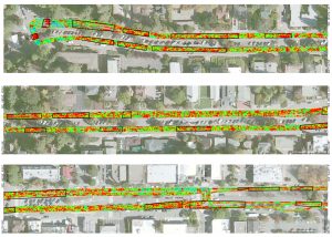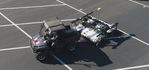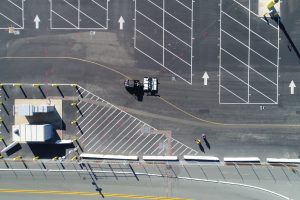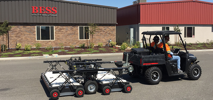
BESS employs the IDS Stream EM for subsurface 3D mapping, a multi-channel ground penetrating radar solution dedicated to utility locating and mapping.
The Stream EM was designed to cover a large amount of area very quickly and efficiently by utilizing a massive array of 40 separate channels, including double polarized antennas to collect longitudinal and transverse pipes simultaneously at a collection speed of 9 miles per hour. This allows the continuous collection of data without interrupting the flow of traffic. The Stream EM can also be interfaced with GPS or a total station to accurately geo-locate the surveyed area. Data collected is interpreted and extracted into AutoCAD or ArcGIS to create a professional subsurface engineering survey deliverable.